Mapping and GIS
Seppe Cassettari was in at the start of GIS in the UK, completing one of the first PhD's in the subject at Birkbeck College, London University in the 1980's. Since then his experience has spanned all aspects of the technology from software development to survey and data caputre through to cartography. Chris Going, is by comparison a late comer, but has fully embraced the technology to suport his interests in aerial imagery and historical sources.
Our combined experience covers researching, designing and building geospatial databases in ArcMap and QGIS. It includes topologically coherent mapping that has a strong 3D component, including a recent project using gaming software to develop 3D models based on a published map base for Tudor London.
The databases can include hierarchical attribution and structures that allow data analysis for time-sequenced features.
We both have a interest in temporal aspects of mapping and recently completed building an integrated historical map sequence based on published maps and library sources for an area of the City of London as part of a study into Shakespearen theatre.
Seppe is also currently working on a temporal geospatial database showing change over 400 years for an English village referenced to current Ordnance Survey topographic mapping and Land Registry records. The data rich GIS files are viewed through an App which allows you to see change through time.
We recently integrated plans from historical sources into modern mapping layers to show possible areas of archeaological investigation in the context of real estate management and urban regeneration.
Current Projects
Update on ETMap: Balsham Experimental Large Scale Mapping Project
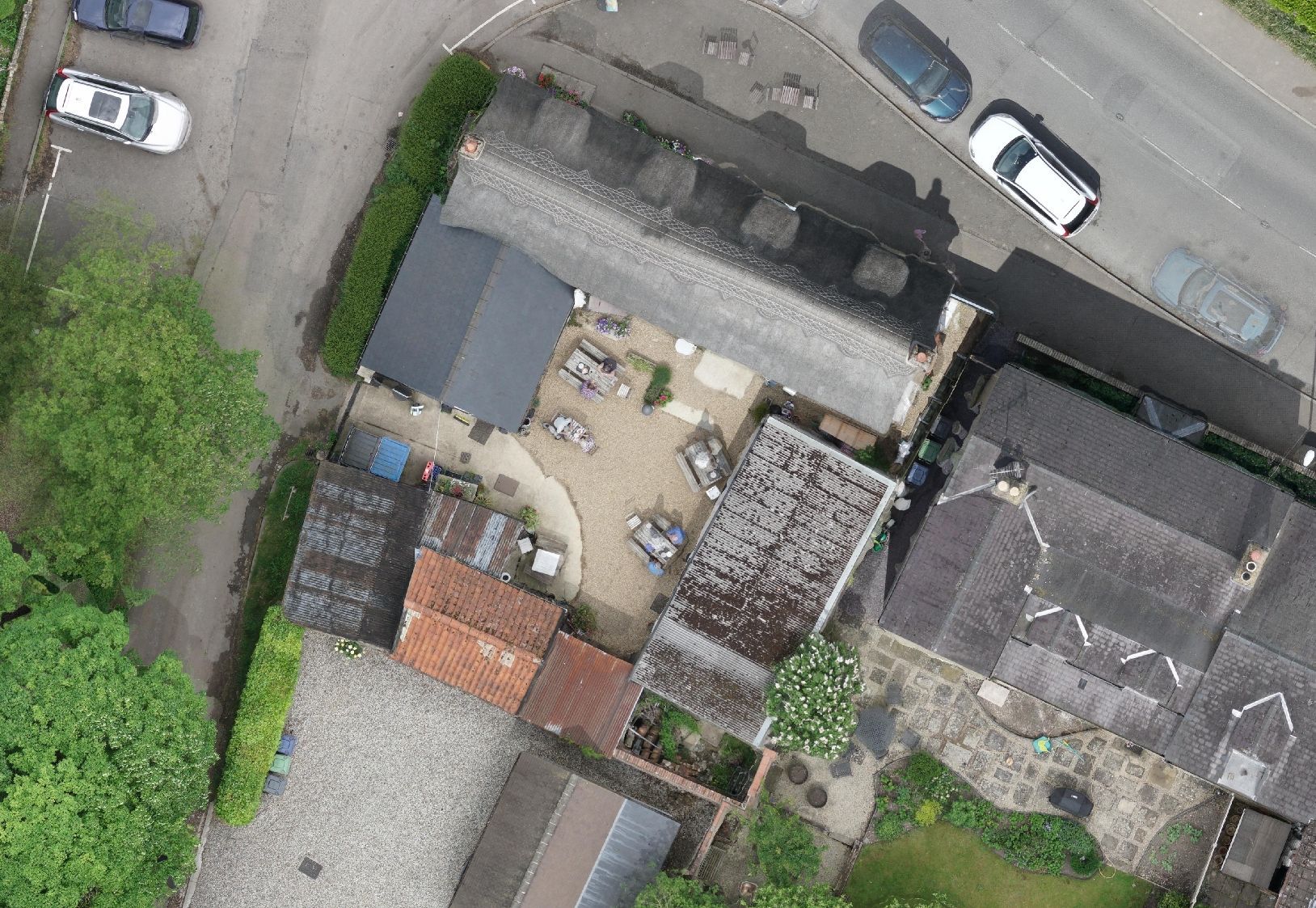
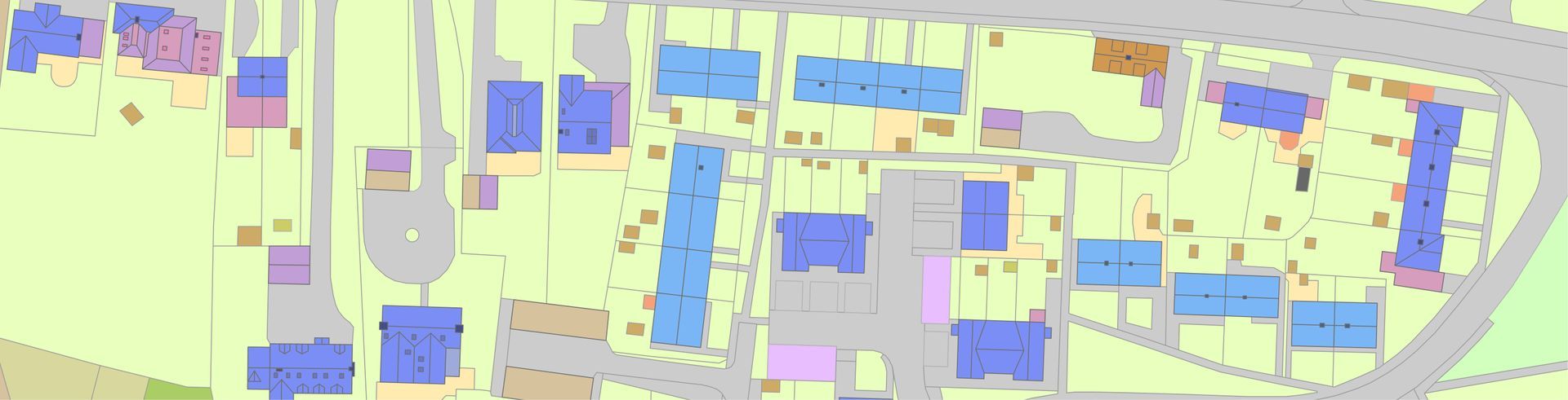
Following the completion of a drone survey in 2022 for the village of Balsham, Cambridgeshire, at a resolution of about 3cm, Seppe has been working on designing and building a very detailed topographic map of the village.
The level of detail in each feature and the resulting complex type and use coding forms the basis of what could be a template for a new generation of large-scale topographic mapping.
The mapping includes information about the currency of the features and allows the user to scroll back through time to see how the village evolved over the previous 150 years.
Based on his experience in creating the ground-breaking and award-winning UKMap, a
large-scale topographic database of London, while running The GeoInformation Group, he is keen to explore what can be achieved with very high resolution drone imagery when integrated with detailed feature classifications including details such as property transactions, planning applications and utility connections.
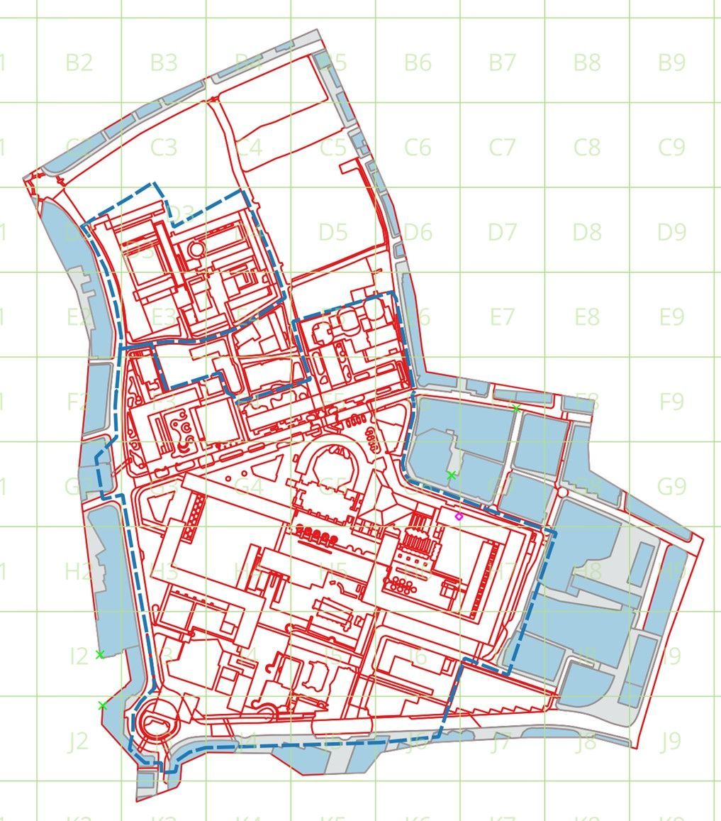
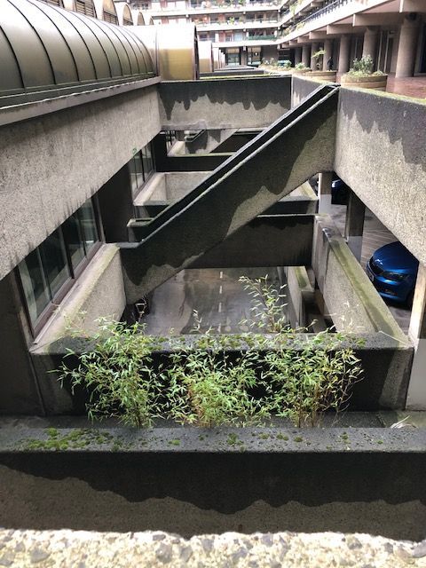
Building a multi-layered map for the Barbican, London
The Barbican in central London is a globally recognised architectural icon, started in 1965 it took 11 years to complete. The residential tower blocks and arts facitilies, such as the Barbican Centre, the Guildhall School of Music and Drama and the City of London School for Girls are built in the Brutalist style - imposing structures of bare concrete.
Built on the area known as Cripplegate, it was heavily bombed during the war so the whole area was completely regenerated.
Famed for its complex structure of raised walkways, tunnels and multiple levels, designed as a 'City within a City', it is both a self-contained village and a thoroughfare for those working in the surrounding areas.
A 3D model of the Barbican in London is the best way to view the area, but such a database is currently difficult to deploy in the field with many of the mapping applications currently in use.
To this end GeoHistopric has been experiementing with the development of a multi-layered 2D topographic map representing the many and complex levels within the site, some of which are publicly accessible, others limited to residents or other institutional users.
The key is identifying the connectors between the levels and the type of access. For example stairs, ramps or lifts with open access, locked gates or keycode access.
The first version of the database is currently being evaluated for its use as a search and rescue tool.
From UKMap to the Enhanced Large Scale Topographic Mapping Specification (ETMap)
A very data rich model for a new large scale mapping specification
In 2009 The GeoInformation Group (TGG) published a new large scale database of London, captured at 1:250 scale and intended to be used at about 1:1,000 scale, called UKMap.
It contained a rich attribute structure which included land use and land cover classifications, addresses and names, a form of the Basic Land and Property Unit (BLPU) and points of interest (POI).
The inital specification and pilot data was created by Seppe Cassettari, who was then CEO of TGG. The UKMap project was recognised by ESRI UK with their Vision Award and in the Cambridge region TGG won Small Business of the Year.
The ETMap project is an extension of the concepts and data model ideas that came out of UKMap.
It includes a greater level of detail, such as roof structures and chimneys, plus more detail on the third dimension. The object referencing system can be linked to information from Land Registry to create BLPU's that are cross referenced to planning applications. The data structure can be used to build 'real world objects' like a property and can be referenced to third party maps like internal house surveys undertaken by estate agents.
This means the database also contains time series information such as a structure's date of build, date of an extension and or when a building was knocked down. This means the database contains multiple, interleaved and time sequenced objects so that historic features can be shown and time series maps created.